Buffalo River Trail - Ozark To Pruitt
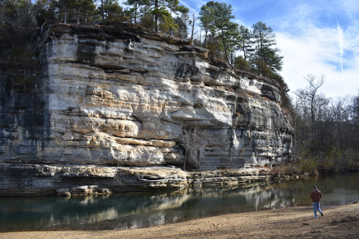
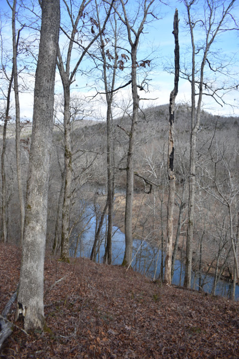
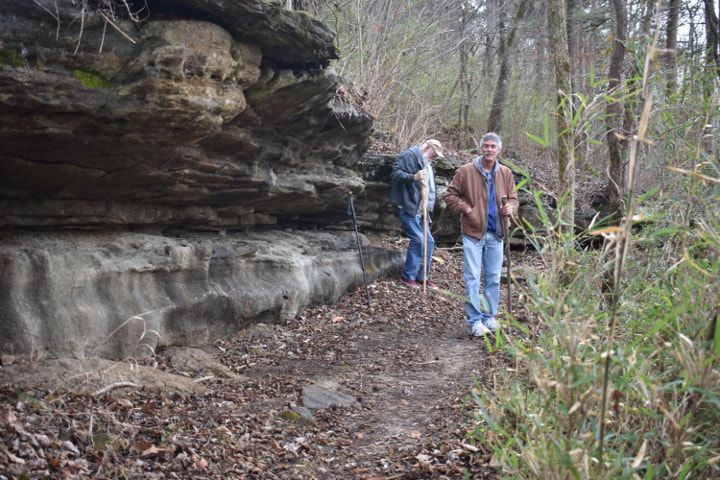
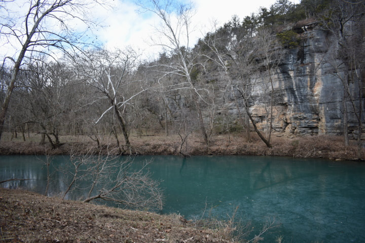
Bluff At Ozark Access
It was January 10th and we had just finished a week of cold weather. Looking ahead we could see another week of simply brutal conditions. Temperatures falling to near zero, but today was sunny and warm and a hike was certainly in order. One of our good friends was back and we were delighted to be able to hike with him again. Our plan was to hike along the Buffalo River Trail from Ozark to Pruitt. It is not a long hike, only 2.6 miles, but it would be the longest hike for me since I had my operation.


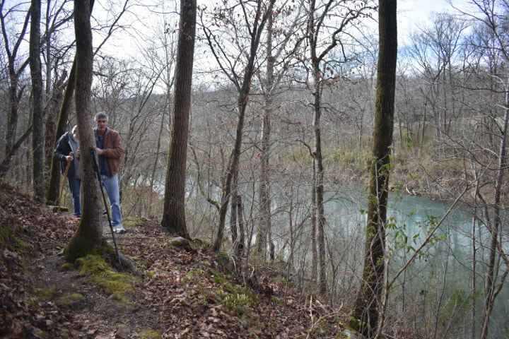
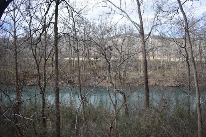
We started at the rivers edge admiring the beauty of the bluffs and then climbed up onto the trail. The Buffalo River Trail follows the river as it makes its way through the Ozarks. Currently the length is about 36 miles of maintained trail. As we walked we could see the river below. It was very beautiful. We passed a decent sized pond which was spring fed, but frozen, with a limb floating on top of the ice.
|
|
|
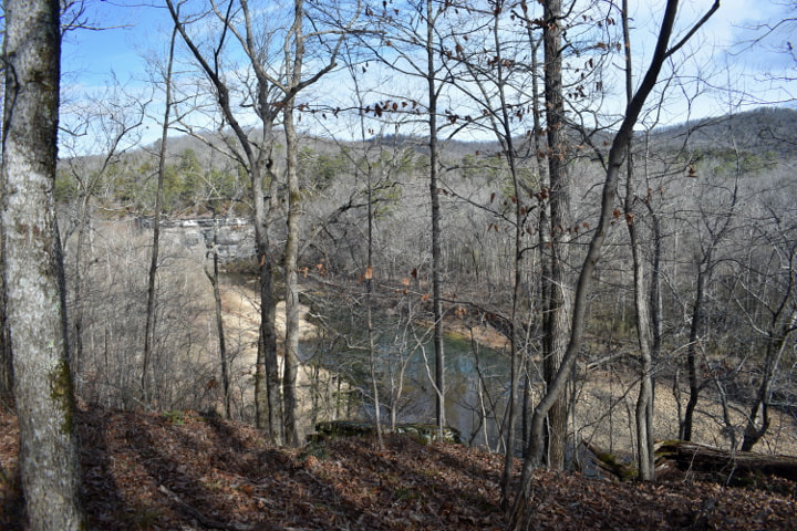
As the day moved from late morning to lunch time we made our way along the trail. In the spirit of John Muir, we sauntered. We came to a spot where you could descend to a overlook that provided a spectacular view of the river and surrounding area. Bill managed to get a panoramic picture of it. He let me publish it below. We had our lunch break at this spot. As we ate we saw a bald eagle soaring above us.
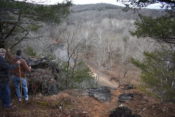
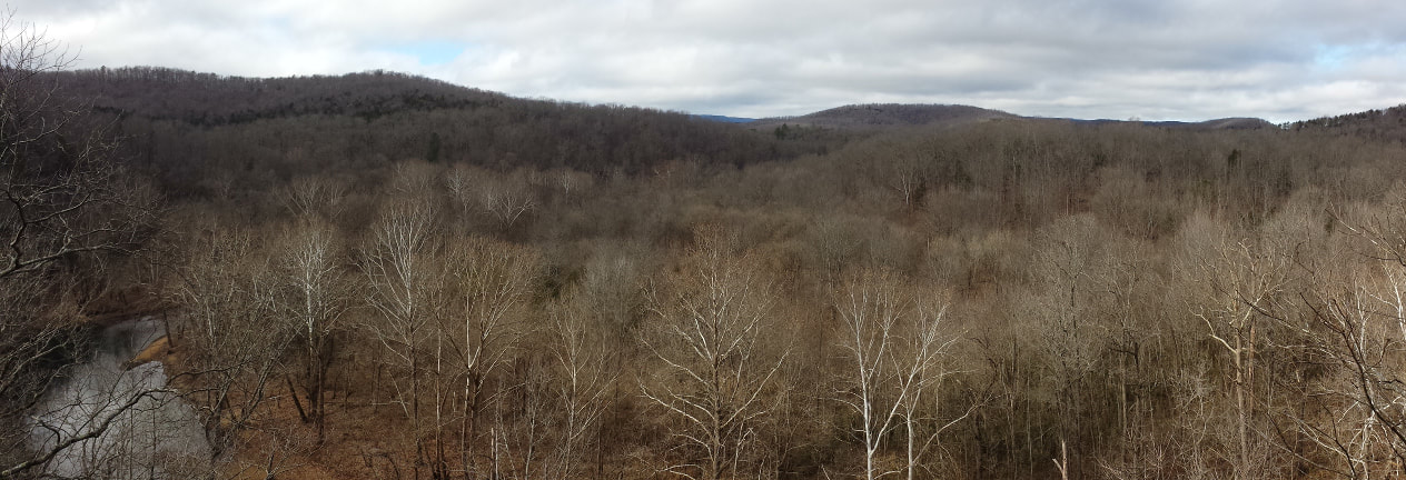
Panoramic View Of The Buffalo River (Click For The Big View)
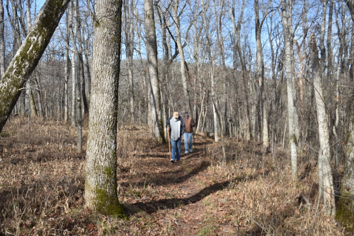
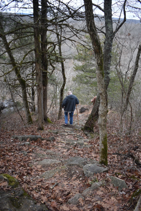
Our light lunch consumed, we took up our walking sticks and continued along the trail. In several places there are small bridges to span places where water runs in wet weather. We took our time, stopping to check out trees that grew right out of rock, outcroppings that had signs of native habitation and wonderful views of the river below.
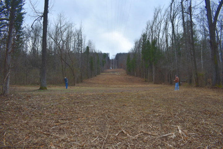
The trail started to slope gently downwards and we knew we would soon be arriving at the Pruitt Access. We stopped to examine some rocks that had interesting fossils embedded in them. Several holes that had been dug also caught our attention as they looked like excellent homes for the wildlife that inhabits the area. No one was home! The trail ends in a field which you cross to get to the Pruitt Access. We arrived to see the utility crews clearing the electrical right of way, working their way from the river up the line.
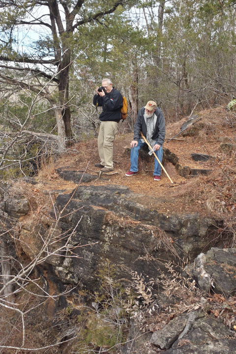
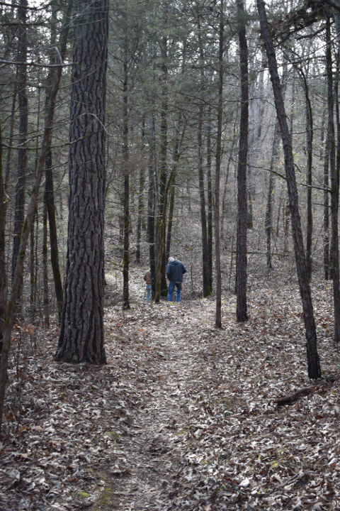
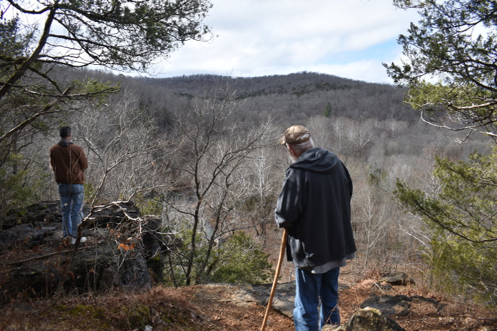
Taking Pictures For The Website
Our walk took about 3 hours but you can do it much quicker if you move faster than we do. We like to stop and examine things, take pictures and generally just enjoy our national river park. All of us feel fortunate to live in such an area of beauty. As I have said before, one of the nice things about hiking the Ozarks in the winter is that usually you can have the surroundings to yourself. We are especially lucky in that we can go during the week. We saw no other person on this hike. I hope you get the chance to take a walk along the Buffalo River Trail this winter. If you would like to read another hike from Pruitt to Ozark that we did 15 years ago, click here.