An Introduction To The Buffalo National River
|
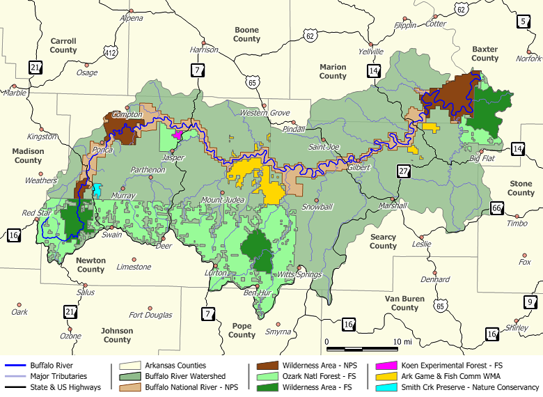
To the west, the Buffalo National River begins as a trickle in the Boston Mountains. It flows 135 miles to the east through the Arkansas Ozarks and into the White River. The Buffalo National River is the only fully protected river in the Ozarks and is one of the few remaining undammed rivers in the lower 48 states.
Following what is likely an ancient riverbed, the Buffalo National River's gradient is steep and the water is fast, leveling and slowing as the river runs its course. The upper section has most of the whitewater rapids to be found along the river, and features dramatic topography including sink holes and caves, springs, and waterfalls, over 500-foot (150 m) tall sandstone and limestone bluffs, and many rock formations. The water temperatures and river levels change dramatically with the seasons, attesting that the river is influenced more by runoff and tributaries than by springs. The river is wild and is protected as such. There are no roads which parallel the river and few easily accessed overlooks; therefore, the best way to see the park is by trail or by water. This National River is managed as three districts, each having individual characteristics and it's own canoe concessions. Each is best reached by primary roads which naturally tend to divide the river. To gain a full appreciation of what the park has to offer, we offer a brief description of the three districts plus other information I hope you will find useful. |

Contact Information
Please call the Tyler Bend Visitor Center for park related questions
Please call the Tyler Bend Visitor Center for park related questions
VISITOR CENTER
Tyler Bend Visitor Center is open all year including Memorial Day, Independence Day, and Labor Day. The Visitor Center is closed for all other federal holidays. Hours of operation are 8:30am to 4:30pm Daily. The visitor center may occasionally be closed for 1/2 hour at lunch time. Phone (870) 439-2502.
RANGER STATIONS
Buffalo Point Ranger Station is open all year including Memorial Day, Independence Day, and Labor Day. The Station is closed for all other federal holidays. Hours of operation are 8:30am to 4:30pm Daily as staffing permits. Please call in advance to be sure the station is open. Phone (870) 449-4311.
Steel Creek Information Station is open seasonally as staffing permits. Please call in advance to be sure the station is open. Phone (870) 861-2570.
EMERGENCY DISPATCH
(888) 692-1162
Park Headquarters
Buffalo National River
402 N. Walnut, Suite 136
Harrison, AR 72601
(870) 365-2700