Vets Day Hike To Round Top
Quietly Remembering
On November 11, I had the day off due to Veteran's Day. This is traditionally a day that my friends who are veterans and I go out and hike. It is our way of remembering those who gave their lives so that we could keep the freedoms that we enjoy as Americans. Their sacrifice should never be forgotten.
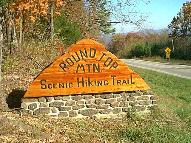
Adventure Bill and I decided to start our Veteran's Day hiking by visiting Round Top. Round Top is a project of the Newton County Resource Council, which received a grant to turn this site into a hiking trail, and a remembrance of those who lost their lives here. In February of 1948, a B-25 bomber crashed into the north face of the bluffs at Round Top. Five servicemen were killed. It is a really neat place to visit, and a very nice day hike. Bill had not been to this site before, so at 10 a.m. we arrived and started up.
Adventure Bill and I decided to start our Veteran's Day hiking by visiting Round Top. Round Top is a project of the Newton County Resource Council, which received a grant to turn this site into a hiking trail, and a remembrance of those who lost their lives here. In February of 1948, a B-25 bomber crashed into the north face of the bluffs at Round Top. Five servicemen were killed. It is a really neat place to visit, and a very nice day hike. Bill had not been to this site before, so at 10 a.m. we arrived and started up.
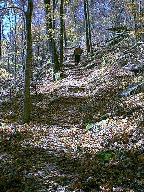
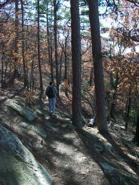
It is a gentle upward climb along a well maintained trail. Benches for resting and just watching, will be found frequently along the trails. Once we reached the bottom of the bluff face, we had to follow a rock stairway up to the top. The highest point in elevation for this mountain is 2050'. When we reached the somewhat flat top of the mountain I had to stop and remove my fleece pullover. The sun had come out, and it was going to be a very nice day.
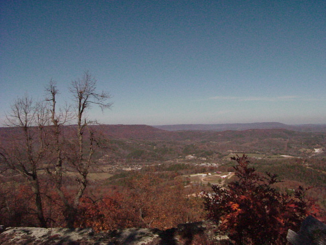
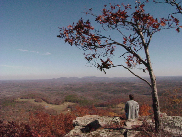
We decided to make for the North Bluff first, and then walk the west trail back down, and over to the South Bluff. Both areas have protective split rail fencing, and benches for having lunch or just gazing out. The walk to the North Bluff was a bit up at first, till you reach the 2050' top point, then down and twisting till you get to the bluff. Once we arrived at this spot, we spent some time just sitting and thinking, and of course taking pictures. One good thing about having Bill as a hiking partner, is that he is not always talking. Sometimes we walk for a long way without anyone speaking a word. The North Bluff faces Jasper, and below we could see the small town, and several of the major highways that feed it.
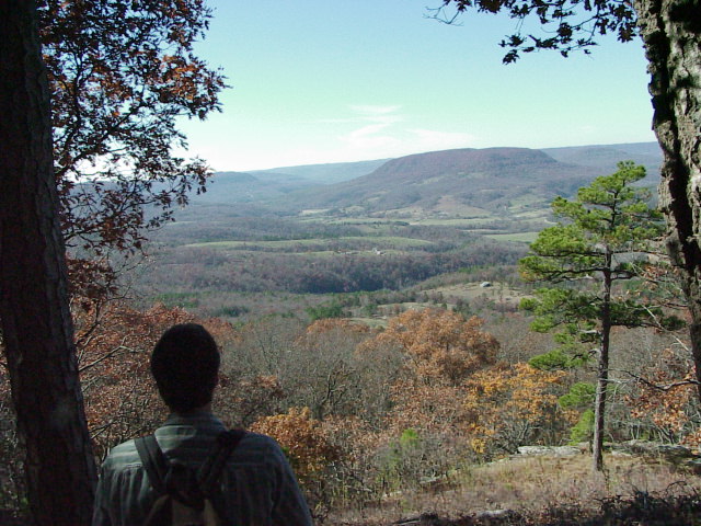
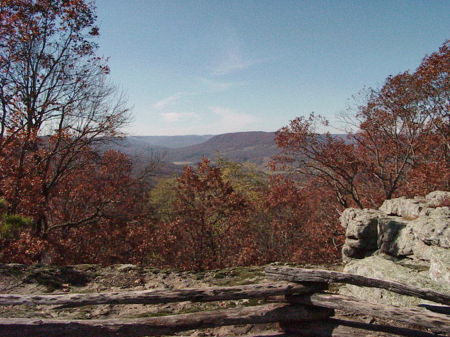
After spending some time on the North Bluff and having a snack, we decided to walk the West Trail back to the high point and then go down to the South Bluff. The walk along this part of the trail system was a bit easier than before, and we had many chances to stop along this trail and simply take in the beautiful scenery. The late fall colors of red and burnt orange stood out against the green valleys and already brown trees. The sun was shining brightly, and we sauntered down the trail, basking in the sunshine and sheltered from the wind that we experienced on the north side of the mountain.
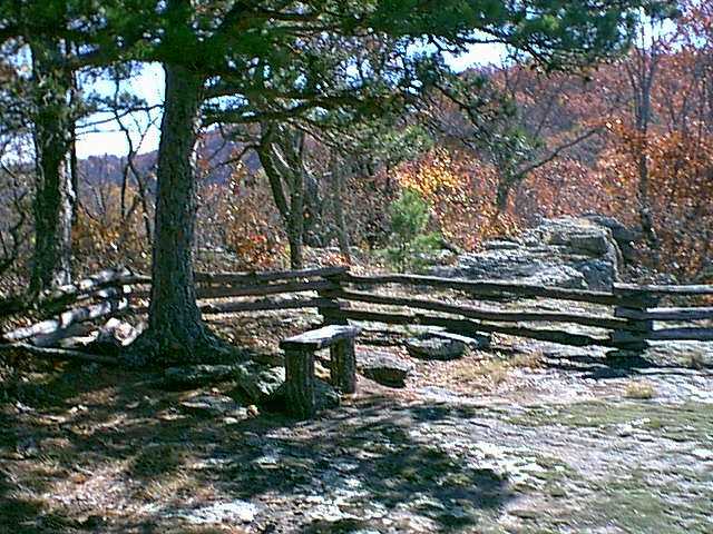
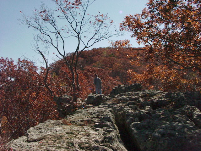
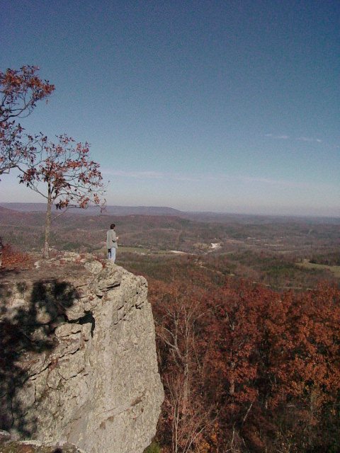
The South Bluff was a much larger area and ended with a finger of rock sticking out, beyond the protective barrier of the split rail fence. The sun was beaming down at us, and it had warmed up considerably since we started our hike. We decided to take a long break here, and then climb down to the interpretive area and have a nice picnic lunch, which we had brought with us. The South Bluff was also protected from the Northwest winds, so it was simply grand to be able to goof off on the rocks, and check it all out in t-shirts. Bill was more brave than I in going beyond the fence line and exploring the rock formations along the point. Bill quickly scampered out to the end of the rocky point. It was a fairly narrow stretch of rock, and not much room for error. This end of the mountain was quite different than the north side, for one, it didn't face a town, but the rural countryside. It was quite pleasant to spend about 45 minutes here, just goofing off, and enjoying the warm sunshine. For November, it was great weather.
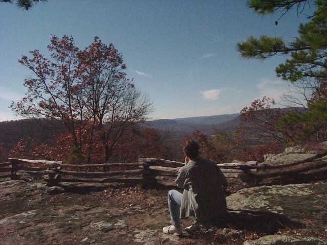
We spent quite a bit of time here. The clear, deep blue skies radiated the warmth of the sun down on us, and it was really a nice spot. It was afternoon, and we were getting hungry, so we decided to head back down the trail, and down to the interpretive center, where there was a picnic table that we could use while eating a lunch. After cleaning up, we took a short tour around the tourist area, which included toilets, an interpretive building and the original engine from the crash.
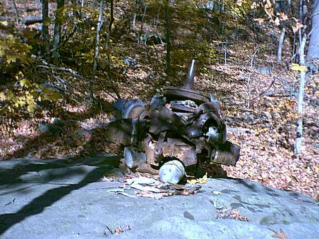
Engine From Crash Site
Our hike to Round Top took approximately 3 hours and we could have spent more time if we wanted to walk around the base of the bluffs. This is an excellent day hike and not very hard at all. It is safe for kids as well as adults. The Newton County Resource Council was responsible for acquiring the land for this delightful trail, and I think they have done an excellent job in providing an area close to Jasper, that can be enjoyed by all. The Ozark Mountains of Northwest Arkansas are full of these types of hiking opportunities, as well as more difficult ones. If you enjoy the outdoors, then take a little time to explore Arkansas in the fall and winter, You won't regret the splendid views